Taunting the Dragon

This post is intended more for pilots than backpackers, presented in layman’s terms for both to read, but it should drive home the lesson that the Natal Drakensberg is Southern Africa’s highest place and must be treated with reverence. In all four of the aircraft accidents mentioned here, the pilots failed to account for the foreboding height of this mountain range.

I was a licensed private pilot many years ago. Several of the aircraft I piloted were later written off by other pilots, and I saw the wreckage of some lying forlornly and accusingly on a hangar floor. Since then, I have encountered two other wrecks in my wanderings in the Natal Drakensberg. The experience has a profound impact, trying to comprehend the sudden finality, the waste of life and a good aeroplane, and the anguish that must have followed.

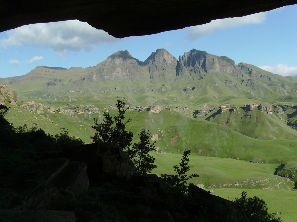
On the first occasion, I summitted Gray’s Pass and settled into Nkosazana Cave with a small school group in heavy mist. It was summer and cattle were lowing across the valley from us, but every now and then we heard the puzzling clatter of metal through the mist. The morning broke bright and clear, and from the mouth of the cave we could clearly make out the wreckage of a light aircraft. It lay about halfway up the back of Champagne Castle, almost directly opposite us. I was unaware of an aircraft accident in this area, so we were obliged to investigate. I later learned that a father and his 15-year old son had lost their lives there a few months earlier, headed toward Virginia Airport at the coast from Gauteng.

There was very little left of the aircraft, which I quickly determined had been a twin-engine, six-seat Piper Seneca. It must have been at its cruise speed of 370 km/h when is left wing tip struck the slope. We could make out this impact point clearly, from the shattered red cover of the port wingtip light. The nose must have slewed to port, but the aircraft hit a rock embankment, disintegrating and exploding at the same time. Its two Continental flat-six engines were the largest remaining parts, but they were badly broken. I found the engine synchronisation tube and the shattered instrument panel, which included a 3-axis autopilot, radio altimeter and what looked to be a complete IFR suite. If the Seneca had been another 200 metres higher, father and son would have reached their destination none the wiser. It appeared that some of the wreckage had already been carried off – by the recovery team, the wind and inquisitive Basothos. One of the wing flaps made its way down to Keith Bush camp at the bottom of Gray’s Pass and remained there for several more years. This was what air crash investigators call a Controlled Flight Into Terrain (CFIT).

A year or two after this accident, another Piper Seneca went missing in the Natal Drakensberg. An extensive search found nothing, but months later, backpackers came across its wreckage near the bottom of Ifidi Pass. This was another CFIT accident. The pilot had flown his aircraft into a 1 km high, vertical escarpment face at 370 km/h. Needless to say, there was not much left to recognise. I heard that coins in the passengers’ clothing had been bent. If you lie on your belly on the edge of the escarpment above the crash site and carefully look down below you, you can still make out the wreckage to this day.

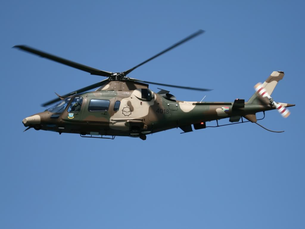
More recently, on 5 December 2012, a South African Airforce AMI Turbo C-47TP (a turboprop-powered Douglas C-47 Skytrain / DC-3 Dakota) carrying a team from Waterkloof to Nelson Mandela’s retirement home outside Mthatha in the Transkei, flew belly-first onto the top of the ridge behind Giant’s Castle at an elevation of 3260 metres (10695 feet), killing all eleven people on board. It was 09h45, Instrument Meteorological Conditions (IMC), and another instance of CFIT where the crew had failed to account for the height of the Natal Drakensberg escarpment. In this case, another 5 metres higher and they would probably have made it. The crash site was found as soon as the weather lifted. It would have been very easy to locate – the point on the map where the aircraft’s stated course and altitude intersected with the ground.

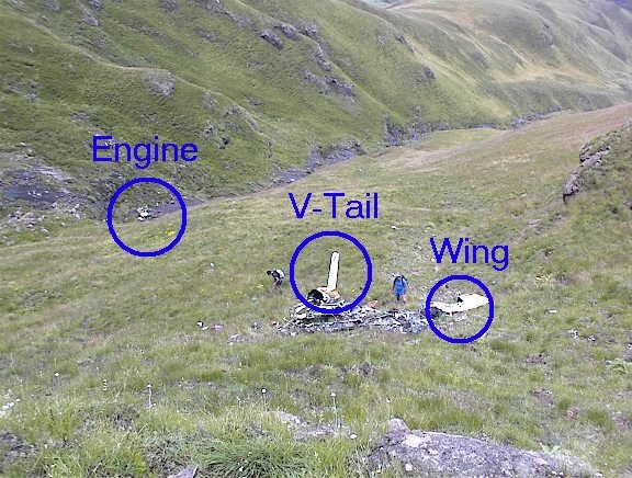
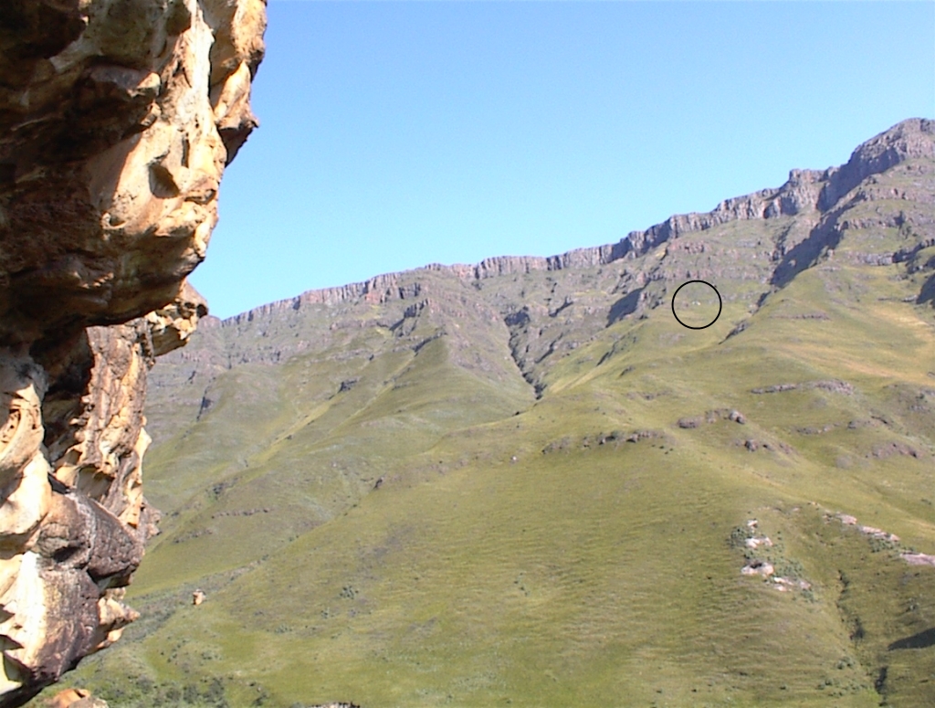
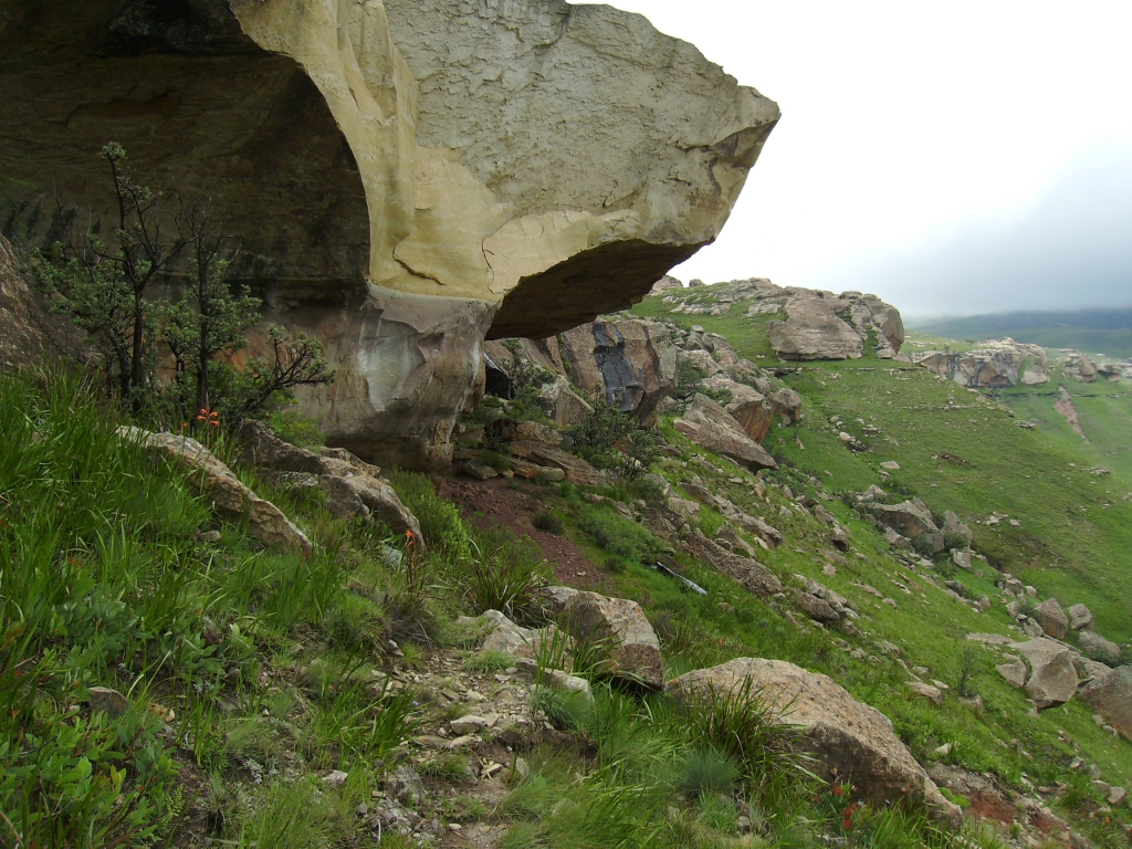
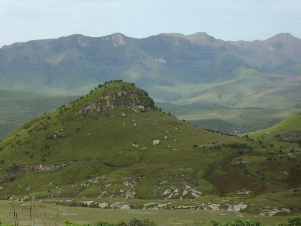
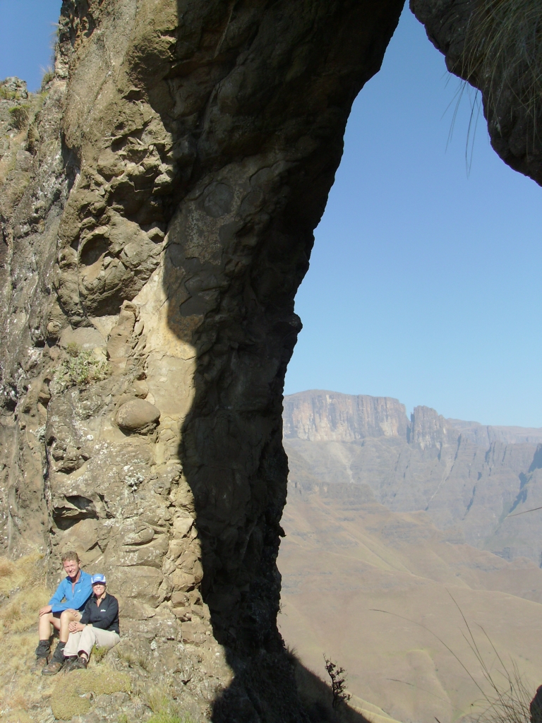
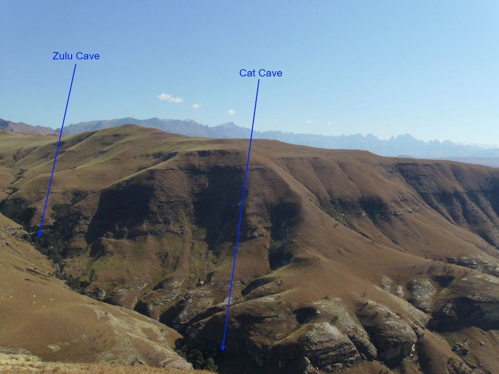
I now want to dwell on the second occasion that I saw a wrecked aircraft in the Natal Drakensberg. This time I was aware that it was there and had seen it from a distance on previous occasions – a tiny white speck below the escarpment near No Man’s Peak in the Garden Castle Wilderness Area. This time, though, I had planned to stay at nearby Fun Cave for two nights so we would have plenty of time to visit the crash site. My goal was to see for myself what had happened. We took only photographs and left everything where we found it out of respect for the families of those who died there, but I did report back to Ezemvelo KZN Wildlife that the site needed cleaning up, which they later did with the help of the SAAF.

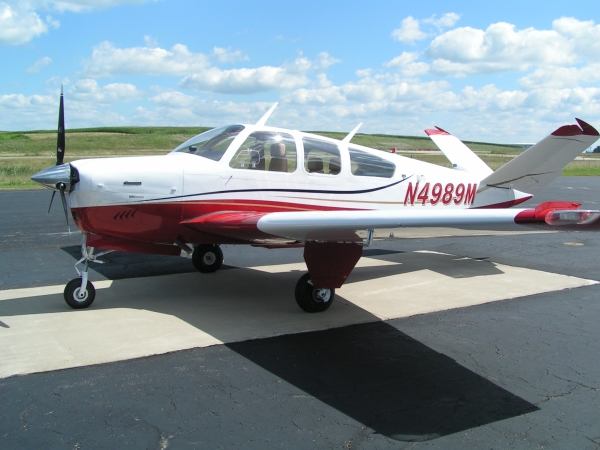
In this case, the aircraft was a single-engine Beechcraft Bonanza V35, where the “V” denotes its unusual V-shaped tail. It flew into a steep mountainside at 13h16 on 10 October 2006, less than 200 metres below the lip of the escarpment between No Man’s Peak and Sandleni Buttress. Three adults and an unborn child were killed in the accident.

An intact Beechcraft Bonanza V35, displaying its V-tail
Wreckage as seen from Speir’s Cave

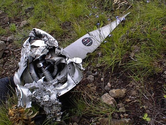
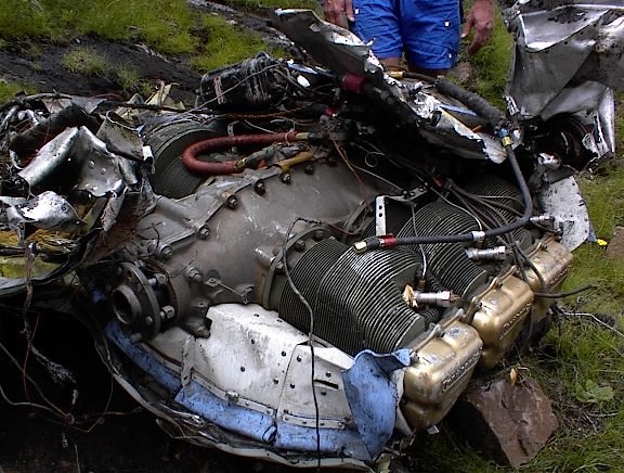
Without backpacks, we climbed the steep spur to the right of the crash site, then headed left across a small tributary of the Umzimkhulu River, where we found the aircraft’s flat-six Continental engine, similar to the ones used in the Piper Seneca, lying almost in the water. The engine was surprisingly intact, but the propeller was completely missing and the metal skin that was still attached had been severely twisted. This suggested that the V35 had not impacted the ground nose-first, that the engine had been running at high power, that the propeller had struck the ground and the torque had ripped the engine from its mountings and sheared off the propeller, freeing the engine and allowing it to roll down the hillside until it came to rest in the stream bed about 50 metres below the main wreckage.

The severed Continental flat-6 engine

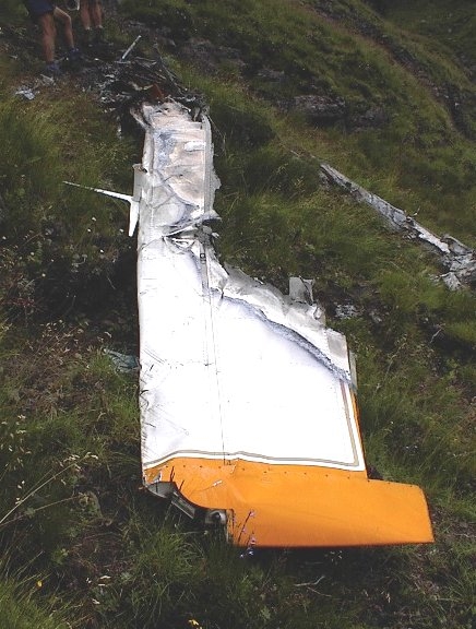
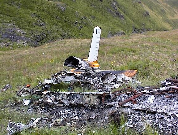
We then headed up the next spur to the main wreckage. It was clear the aircraft had caught fire, but it had not completely burned out even though the fuselage had remained in one piece. Both wings had been sheared off. The integral fuel tanks in the wings had completely burnt out, taking the wing skin away, but curiously, close to the edge of where the tanks had been, there was unscorched white paint. These observations suggested that the aircraft might have come down in rain, so although there was a fire, the rain extinguished it before everything was completely burnt out. The fact that the fuselage had remained in one piece after the impact with the ground suggested that this contact had taken place at a relatively low speed – perhaps the stalling speed, which would have been around 120 km/h “clean”, at this altitude and load. This presented the horrifying spectre that the pilot could see the ground rising beneath him and had tried to take evasive action by opening the throttle fully and pulling the nose up into a steep climb.

Most of the fuselage was burnt out
The V-tail was mostly intact
One of the wings with its burnt out fuel tank

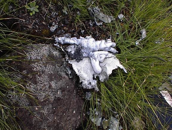
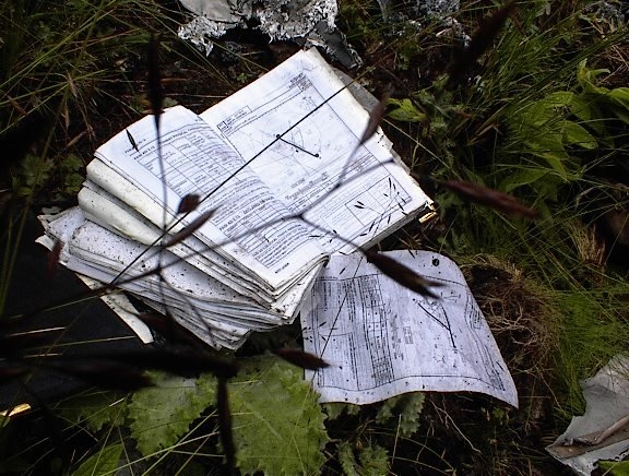
We came across some haunting personal effects: a pair of neatly folded blue jeans with fire damage; a dented deodorant can; a Smith’s Pilot Guide lying open in the grass with edges burnt and a page flapping on the gentle breeze. These had been real people whose lives should still have lain ahead of them. Further to the left on the spur, under a small, low rock overhang, I found what I presumed to be the aircraft’s locator beacon, whose battery had been removed. It had just been left there, as if to say that the hunt for the crash site was now over.

The tattered remains of a pilot’s manual

Ahead of the fuselage, the most significant items were the destroyed propeller, including its variable pitch hub, and the nose-wheel leg complete with its very heavy lead ballast. One propeller blade had been torn off, while one was almost straight, again suggesting that it had come to an almost instantaneous stop. The tip of the propeller spinner was obviously damaged, but its condition confirmed my earlier notion that the aircraft had pancaked onto the ground. The aircraft may even have been “hanging” on its propeller – i.e. pointing almost vertically and about to fall backwards. If so, it would have hit the ground at much less than 120 km/h, suggesting a possibly survivable impact except for the ensuing fire.

The damaged propeller hub
The missing propeller blade seems to have melted

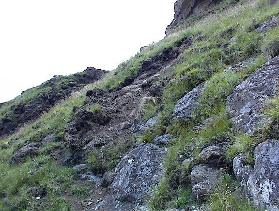
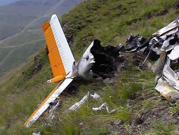
Above the wreckage was perhaps the most significant tell-tale sign of what happened during the aircraft’s last moments. Above an embankment, and just below a cliff face, a heavy impact scar was clearly visible. I surmised that the pilot had seen the rising ground, pulled the V35 into a steep climb at full power in the hope of getting over the escarpment, then saw the cliff face coming up, pulled back further into a climbing left turn, hanging on the propeller or perhaps already entering a full stall, at which point the propeller struck the ground, breaking the engine free of its mountings, ripping off the nose gear, and releasing the fuselage, which then slid backwards downhill before coming to rest. The wings would have broken off during this slide.

The impact scar above the main wreckage
The wreckage as seen from the impact scar

The Civil Aviation Authority’s official accident report, which I only came across recently, lists the root cause of the accident as the pilot’s failure to revise his altitude after selecting a more direct route to Bloemfontein. A passenger or air traffic controller who knew the Natal Drakensberg could have warned him of his error. No Man’s Peak is 3100 metres or 10170 feet above sea level. The pilot had chosen to fly at 8000 feet and impacted the ground at 8957 feet (2730 metres) while climbing to avoid the rising terrain. Even if he had been able to clear the edge of the escarpment, he would still have had to clear the ridge behind No Man’s Peak, which is not much lower than the peak itself. To safely clear the Drakensberg mountains on this heading to Bloemfontein, the pilot would have had to fly at an altitude of at least 12700 feet. He was flying almost 4000 feet too low – another case of CFIT. To put this into perspective, the highest peak in the United Kingdom, Ben Nevis, is 4413 feet!

Not mentioned in the report is the influence the presence of a pregnant passenger may have had on the pilot’s decisions. She was apparently due any moment, hence, possibly, the rush to get back to Bloemfontein. The Beechcraft Bonanza V35 is unpressurised and this one was apparently not carrying oxygen. The pilot may have wanted to avoid subjecting her and her unborn child to high altitude flight, where the risk of her getting hypoxia would have been much greater. In any case, air law requires that, for flights exceeding 30 minutes at cabin pressure-altitudes between 10000 feet and 13000 feet above sea level, pilots of unpressurised aircraft must use supplemental oxygen. Failure to do so can result in hypoxia, whose effects are very similar to being drunk. The difference for backpackers is that they usually have time to acclimatise before reaching this altitude and can therefore manage without supplemental oxygen. Even so, some hikers still suffer from altitude sickness at the top of the Natal Drakensberg escarpment.

Beware, all you who enter into the dragon’s lair. Do not taunt it, for it will awaken to smite you down, then return to its rest. Step softly, step carefully, lest you wake it once more!

Wreckage Impact Scar Melted Metal Propeller Hub Smith's Pilot Guide Wing V-Tail The Main Wreckage Engine Beechcraft Bonanza V35 Beechcraft V35 Crash Site

The Mountain Dognappers

On one of my Grand Traverses, I was sitting huddled against a rock at the top of Bannerman Pass, awaiting the arrival of our resupply team. A cold wind was blowing. Suddenly, a long pink tongue curled under the peak of my cap and almost lifted it off my head. I looked up into the face of a large dog, whose nearest relative must have been an Irish wolfhound. He had a coarse, curly ginger coat, and other than his unkempt appearance, he was a fine looking fellow. His stump tail was wobbling uncontrollably. I wondered where he had come from. He could have been a Basotho shepherd’s dog that had grown tired of the harsh lifestyle and opted out when he saw the chance. Or he could have been a farmer’s dog that had got lost chasing Basotho dogs or buck onto the escarpment.

“Buddy”, as someone named him, decided to tag along for the rest of our traverse southwards, continuing on with us past Sani Pass and ignoring the warm fires and nice lady dogs there. He was good company, and there were just enough scraps after dinner every day to keep him fed to his satisfaction. That year was a particularly dry traverse, and our only problem with Buddy was that he always got to water before we did, and then stomped around in it. One of our team members took such a liking to Buddy that he took him home with him after the traverse. I assume that Buddy lived out the rest of his days in his new master’s large backyard.

On another occasion, I did a traverse from Sani Mountain Lodge Backpackers to Bushman’s Nek. There used to be a large black dog at the backpackers that looked like a Newfoundland or Saint Bernard. He was very promiscuous and probably died of exhaustion, because I haven’t seen him there on recent visits. On this occasion though, when we headed out towards Hodgson’s Peaks in the morning, we were accompanied by two other Basotho dogs. They were of medium size but one had very short fur while the other was quite woolly. They were the best of friends to each other.

We assumed that at some stage the two dogs would turn around and head for home, but they did not. It was getting towards winter and they stayed with us in the tunnel at Sandleni Cave. The following night they stayed with us at Mzimude Cave which is quite exposed and it was very cold. The less well-clad dog was whimpering, so we covered her with a spare groundsheet and she settled down. We fed them what we could from our meagre rations.

The next day we headed towards Thomathu village in Lesotho. Some ladies and girls were in the fields harvesting wheat with sickles, while a few young men stood by waiting to take the sheaths back to the village on sleds pulled by oxen. As usual they had dogs with them, so we started growing concerned about the potential for a dog fight. However, the Basothos had complete control over their dogs and after some initial disturbance they all settled down, although “our” ones were looking nervous and stayed close by our feet.

We had been wondering what we were going to do with our two companions. Dogs are not allowed in Ezemvelo KZN Wildlife wilderness areas and we could not take them home because none of us had room for them. Efforts to get them back up Sani Pass might prove fruitless and then someone else would be landed with them or they would have to be destroyed.

In broken English, one of the men asked if they were our dogs. When we said “No”, he asked if he could have them. We decided that was a good solution to our dilemma. Rural Basothos seem to be good dog handlers. They lassoed our two dogs with ease. The dogs complained bitterly and looked really hurt that we did not come to their aid. The one dog became quite aggressive towards its captor, whose eyes lit up in delight that he had acquired such a dog, ideal for keeping other dogs and jackals at bay. The Basotho captors left with our two dogs, reigning in the length of the lassos as they walked. By the time they disappeared around the corner, the dogs were walking resignedly next to them.

A previous Ezemvelo KZN Wildlife conservation manager at Monk’s Cowl had two dogs. The one was a beautiful English pointer named Frere, the other a Jack Russell. The latter could only ever walk on one rear leg at a time, and when it managed to escape its fenced yard, it would often join visitors for short day hikes within eyeshot of its home.

Over a 3-day long weekend in August 2004, I led a group of very fit hikers on a challenging route up Gray’s Pass and down Ship’s Prow Pass, a distance of 40 km and a height to climb of 1895 metres. As we were approaching the small gate on the path going up to Crystal Falls, the (small) Sphinx and Breakfast Stream, a white flash streaked past me. It was Frere, who was clearly excited about her escape and the prospect of joining a “proper” hike, unlike her little companion. For the next three days, Frere ran first ahead of us, then back to check on our rearmost hiker, and then ahead of us again, repeating this behaviour many, many times over. She probably covered at least 100 km in all. She had no problem ascending Gray’s Pass, although we had to help her up some of the clambers as we did for each other.

It was -8 °C in Nkosazana Cave, and being a short-haired dog, Frere was very cold and not even the least bit interested in the little striped mouse that was running all over us and our stuff. A kind young couple draped spare fleece jackets and a groundsheet over her, she enjoyed my spare hamburger which she took ever so gently out of my hand when I offered it to her, and slept peacefully with the rest of us.

The next day we traversed behind Champagne Castle and headed down the dreaded Ship’s Prow Pass, eventually reaching a suitable camping spot just above the contour path. Frere slept the second night in the bell of the young couple’s tent. In the morning though, when they tried to get her out of the bell so they could get out themselves, she let out a howl of complaint and refused to budge.

On inspecting her, they discovered that Frere’s front paws were cracked and bleeding and she did not want to stand on them, let alone walk. Now Stephan is a sports kineticist and always carries an impressive first aid kit on his hikes. He taped up her damaged paws, administered a pain killer, and within a few minutes Frere was right as rain again.

We headed back towards our starting point at Monk’s Cowl, with Frere doing her usual “go ahead and check, then go back and check” thing. At one point on the contour path as we were approaching Blind Man’s Corner, she suddenly stopped ahead of me and pointed. That was when I realised that she was a real birding dog, except that this time she was pointing at a herd of eland for us. When we reached the same gate where she had first joined us, Frere suddenly bolted for home. On reaching the office, I asked if I could phone the conservation manager and explain to him why his dog had arrived home with bandaged paws. He was quite amused and said it was not the first time she had disappeared for a few days to join overnight hikers.

Shepherd Dog Shepherd Dogs

White Squalls

If you have ever seen the 1996 movie White Squall starring Jeff Bridges, you will have some idea of what a white squall looks like at sea. According to Wikipedia, “A white squall is a sudden and violent windstorm at sea which is not accompanied by the black clouds generally characteristic of a squall. It manifests as a sudden increase in wind velocity in tropical and sub-tropical waters, and may be a microburst.

Microbursts also occur over land and have been identified as the main cause of some devastating aircraft landing accidents. Unsurprisingly, given the violent summer storms in the Natal Drakensberg, they happen there too.

My first experience of one happened many years ago when I was leading a group down from The Hub to Gxalingenwa Cave. It had been an oppressively hot afternoon, and at a narrow section of the Gxalingenwa Valley just above the cave, we stopped for a swim. With additional heat radiating off the rock faces there, it must have been close on 40 °C. A major storm had been building over the Giant’s Cup, and the first indication that something was about to happen was when a few large hailstones starting falling amongst us.

We made a beeline for the cave, entering it via the top approach and the waterfall to save time. We had no sooner arrived than a white wall passed down the valley in front of us. It was not mist – it was a vertical wall of white, marking a sharp boundary between the clear air in front of it and the hail and very heavy rain behind it. The precipitation was so intense that it did look a little like mist while it was over us. The worst was over in less than 5 minutes, but the storm continued unabated overhead for another hour.

One day, returning home after a hike, we ran into a microburst on the road just outside Bulwer, on the way down the Umzimkhulu Valley. I had the headlights on, and the wipers were making little difference to visibility even though they were on maximum speed. There was some hail too. The next moment we popped out of the wall of the microburst with the wipers flailing wildly, and us squinting in the sudden brightness. The road was bone dry. We passed a lady walking in the opposite direction. She could not have had any idea of what was coming her way.

On another hot afternoon, we were busy settling into Vaalribbokkop Cave in the Monk’s Cowl area, fetching water and washing off the sweat at the junction of the streams below the cave. I had just returned and was hanging stuff out to dry when I noticed a wall cloud coming up the valley. Some of the others were still making their way back and were about halfway to the cave. There is a big, smooth rock at the front of the cave which makes an excellent stage, so I jumped onto it, yelled at the stragglers, pointing to the wall cloud and miming for them to run!

They got the message and ran, making it into the cave as the wall cloud reached us. It had been approaching at probably around 20 km/h. Again, as it passed over the cave, it contained torrential rain and a lot of hail. Some of the hailstones were ricocheting off the rocks into the cave. And then it was gone!

Being by now fairly familiar with these wall clouds, or “white squalls” as I like to call them, put me at an advantage on the next occasion that I encountered one. We had stopped at Lakes Cave in the Cobham area for lunch, and a major storm was once again developing over Hodgson’s Peaks. We were headed for Glade Cave, so as soon as lunch was over, we left Lakes Cave and started making our way up to the tarns on the ridge above it. I was in the lead, and as I approached the summit of the ridge and could see over it, I looked straight into a wall cloud.

I yelled to everyone to get back to Lakes Cave as fast as they could, no explanation given other than that “all hell is about to break loose!”. I was even encouraging them to run if they could, but to be careful not to twist an ankle. We arrived back under the shelter of the cave only a few seconds apart, everyone looking at me in expectation of an explanation. All I said was “Watch!”. On cue, the wall cloud reached us and there was torrential rain and lots of large hailstones. This time, the wind was gusting so hard I thought we might even have a tornado on our hands, so we got the smallest kids to climb up onto the ledge at the back of the cave and wedge themselves in there. Again, it was all over is less than 5 minutes and we continued on our way.

I have never seen a fully developed tornado in the Natal Drakensberg, but I have little doubt that they do occur. The rural village of Impendle, which is not far from Underberg, has had two devastating tornadoes. I was on the plateau below Lammergeier Cave once, heading down to Surprise Cave, when we saw a funnel cloud drop out of a storm cloud over the Bushman’s Nek Valley. We watched fascinated, then with growing alarm, as the funnel slowly stretched downwards towards the valley floor. My mind was racing about what to do if it came our way. There was a long rock band just behind us with a low, shallow overhang, so I decided we would have to lie down on our sides using our shoulders to wedge ourselves under it and our backpacks for protection. When I looked back at the funnel though, it had slewed horizontally and then it disappeared.

Bouldering Accident Near Tarn Cave

In July 2010, I led a small group of teenagers and a teacher on a hike to Tarn Cave via Bushman’s Nek Pass. This is one of my favourite caves, but not so much for the cave itself because it is very breezy and heavy mist often rolls into it. Its main attraction is the splendid views it offers of the Devil’s Knuckles and the whole of the southern Berg escarpment. There are also some picturesque tarns in the area, and a fantasy world of rock formations everywhere you look.

After summiting the pass and heading along the border fence towards the main tarn above the cave, we stopped to admire some of the rock formations, whereupon the boys starting clambering over them to gain a height advantage.

On his descent, a 16-year old boy named Devon decided to do some bouldering and had his legs resting horizontally in front of him against the rock face while he hung from it with his arms, about 2 metres off the ground. As I watched, he tried to swing his feet down to the ground, but he let go too soon with his hands and landed hands first on the shale stones below.

With a yell of pain, anguish and disbelief, he rushed towards us holding his right wrist in his left hand. The pit of my stomach churned when I took a look at what he had done to himself. His right arm ended in a stump and his wrist and hand were parallel below it. It looked like a dislocation or possibly even a break and he was shaking in agony.

We completed the remaining 250 metres or so to the cave, got him seated and gave him some Myprodol for the pain, but only after carefully reading the instruction leaflet to ensure it was suitable for someone his age and to get the dosage correct. Administering medication to a student is normally an absolute no-no.

I usually wrap pre-cooked meals, chocolate bars and slabs, cheese and other heat-sensitive food in layers of newspaper to insulate them, and this hike was no exception. I gathered together 3 sheets of our local newspaper and wrapped them loosely around Devon’s arm as an improvised splint, with just his fingers sticking out. He found this so comfortable and supportive that he removed it only reluctantly when he eventually got to a hospital.

By now it was early afternoon and I had to make a decision about what to do next. I thought it would be best to find a horse to get him down the pass as soon as possible, but it was unlikely to be the same day because that would involve moving at night and arriving at the Bushmen’s Nek border post after it closed, which would further extend the journey over rough ground. We had travelled up in a school minibus, so we were going to have to stay together and I was very reluctant to put everyone through the rigour of a return trip the same day. It would also mean driving on livestock-infested, pothole-ridden roads at night. The risks seemed too high to even contemplate.

Now for the horse. I know the Sehlabathebe area quite well, so with another student in tow, I headed off in the direction of the old lodge in the hope of finding a horse there or organising one from one of the Lesotho villages nearby. The game guard tried to contact his headquarters office at Sehlabathebe village by radio, but to no avail. They were closed for the rest of the weekend. These options were a dead end and we returned empty-handed.

One can get cell phone reception about 150 metres from the cave, so we managed to contact a doctor (I am not sure who it was now) to ask for advice. I was given very alarming information – if blood vessels had been badly damaged, Devon could get a clot and die during the night. That was not what I wanted to hear. I asked for more information about what to look out for, and I was fairly satisfied that the situation was not that dire because Devon’s wrist showed no signs of internal bleeding or going blue, and there was surprisingly little swelling. I had to weigh up the risk of him dying versus all of us heading back in the dark to the minibus, and then running another gauntlet back to a hospital, perhaps in Howick.

Devon seemed settled and comfortable, everyone else by now was also settled in and preparing their evening meal, so I made the judgement call to stay put. We did contact Ezemvelo KZN Wildlife and tell them we would need a horse first thing in the morning to get Devon back down.

The teacher and I checked on Devon throughout the night, but he slept very well and we felt bad having to wake him just the once to repeat his dosage. In the morning, he woke and was up and about as though nothing had happened, and even accompanied me to the tarn where we met some game guards who must have left in the early hours of the morning to reach us. They looked a little peeved to see our patient so mobile. With a jacket sleeve pulled down over the makeshift splint, you could not tell him apart from the other boys. The game guards arrived sans a horse or even a stretcher, so I have no idea what they had in mind.

Devon was adamant that he was OK to hike back, and even donned his backpack, so that was that. We improvised a sling to support his arm, and returned via Bushman’s Nek Pass because it does not involve any clambering, unlike the alternative route. He even made his own plans to meet a friend in Hillcrest when we got back there, who would then take him to a hospital. When he was finally x-rayed, it turned out that he had a greenstick fracture.

Tarn Cave View Tarn Cave Tarn Cave tarn.jpg

Vaalribbokkop Cave Helicopter Evacuation

Some years ago now – perhaps in November 2012 – I led a weekend hike to Vaalribbokkop Cave in the Monk’s Cowl Wilderness Area. This is one of my favourite lower Berg caves. There are several route options so it never gets boring. While nearby Stable Cave offers far more spectacular views and some vulture watching, finding water there is often a challenge so I usually avoid it except in high summer.

On this particular occasion, our outbound route took us via Jacob’s Ladder. This is not an actual ladder but a series of zigzags on a well-worn path up the southern side of the Culfargie “bowl”. The bowl is a semicircular valley, and it is notorious for trapping heat, so inevitably, in all but the coldest weather, Jacob’s Ladder is a good 5° Celsius or more warmer than anywhere else on the route.

We had just settled down in the shade of some proteas at the top of Jacob’s Ladder to cool off and take in the views over the Natal Midlands, when one of the ladies in our group named Jenny mentioned that she was not feeling well. We were all extremely hot and bothered, so we assumed she had heat fatigue. She downed some electrolyte and after about 30 minutes, when she said she was feeling a little better, we set off to complete the rest of the climb up to the small plateau near Stable Cave.

Jenny took another break in the shade of some more protea shrubs while the rest of us paid a quick visit to Stable Cave. There was no water there, so we set off to complete the remaining 2,5 km to Vaalribbokkop Cave. By now she was straggling, but we were so close to our overnight stop that we pressed on slowly and arrived there in the mid-afternoon.

Jenny was starting to feel quite ill, so we got a sleeping spot arranged for her under the yellowwood trees, organised some more electrolyte drinks, and left her to recover with some ladies in attendance. However, her condition deteriorated further and she had a resting heart rate of around 120. This was alarming, and considering that she was now well-rested and rehydrated, the problem was looking less and less like heat fatigue or heat exhaustion to me. She was also becoming extremely anxious and upset.

Late in the afternoon, she confessed that she was suffering from hypertension, that she had just changed her medication, and that it was obvious to her that her doctor had not got the dosage correct yet. This was now clearly a very serious situation, and there was no way our patient was going to be able to hike back to our starting point.

There is no cell phone reception at the cave, so we sent some runners out towards the cliffs above Culfargie to contact Monk’s Cowl and relay our predicament, indicating that we were going to need a helicopter extraction. They agreed and said they would arrange a helicopter to collect her early the following morning. Jenny calmed down a bit after hearing the news. With ladies attending to her all night, her condition still did not improve, but it did not deteriorate either.

Before dawn the next day, our runners went out to report on her condition and confirm that a helicopter was still needed. An Oryx from No. 15 Squadron was ready to leave from Durban, but the Midlands where clouded in. The rescue coordinators decided to contact Cathedral Peak Hotel and ask them to send the helicopter based there for sightseeing trips to come and fetch her instead. The Robinson 44 arrived as soon as the sun was up, Jenny and her kit were loaded into it, and the pilot flew her away to Ladysmith Hospital. This is the standard destination for the completion of rescue flights, because Ladysmith seldom has mist. She made a quick recovery once the doctors sorted out her medication.

Vaalribbokkop Vaalribbokkop

First Rescue by a SAAF Agusta A109 Helicopter

Over the weekend of 18-19 November 2006, I led a hike to Zulu Cave in the Monk’s Cowl Wilderness Area. We took the most direct route via Hlatikulu Nek and then down the Mhlwazini River.

Our large group of 12 enjoyed the spring flowers and quartz crystals, but we were also entertained by the South African Air Force (SAAF). 87 Helicopter Flying School based at AFB Bloemspruit outside Bloemfontein had some of its brand new Agusta A109 Light Utility Helicopters flying in the area. They were doing mountain training flights out of the SAAF’s satellite base at the Dragon Peaks Mountain Resort. This base is also used by Durban-based No. 15 Squadron‘s Oryx helicopters for their mountain training, and most importantly for search and rescue in this area of the Natal Drakensberg.

Being an avid aviation enthusiast myself, I was quite spellbound by the antics of the Agustas. They were flying up the Mhlwazini Valley from the Brotherton Store area at very low level, slapping the air in a tight 90° turn at Eagle Gorge, and then climbing steeply up towards Intunja (Gatberg) and the escarpment beyond. Then they would dive off the escarpment and come whizzing back past us almost within arm’s reach. Another favourite was an energy-loss manoeuvre, where they would pull into a tight 360° turn over the campsites at the river crossing below Intunja, lowering their undercarriage as they did so and completing the turn in a hover.

Our main objective for this hike was to summit Intunja and also traverse into its hole. Both require a steady nerve and a head for heights. SAAF helicopters quite often touch down on the summit of Intunja, so I was hoping we were not going to be competing for space with the Agustas. I was also concerned that they might cause a distraction when we could least afford this. I was sure they would not deliberately fly over us while we were teetering on a free-standing mountain top, because their downdraught could be disastrous.

We left Zulu Cave early on Sunday morning and headed up towards Intunja. My approach involves climbing about halfway up Intunja with our backpacks, and then leaving them where the path from the campsites reaches the ridge.

As usual, a willing volunteer or two stayed with our backpacks as the rest of us made our way up Intunja. There is a pair of crows living in the area that will ransack any unattended backpacks. I learned this the hard way on a previous occasion when we saw them going into our packs while we stood helpless on the summit of Intunja. They also know how to undo zips using their beaks, so nothing is sacrosanct. On cue, they arrived as we started our final ascent, squawking loudly about their lack of fortune as only crows can.

After our successful summit, some of us traversed into the hole. This is the scariest bit and there is no room for error. Then we descended back down, collected our packs, and started the ridge descent down to the river. This is a knee-jolter all the way until you cross a small tributary. In fact, the first 100 metres or so of this ridge are also a real hair-raiser.

On reaching the tributary, one would think that the worst is over, but crossing the stream is a little tricky and many will have quite wobbly legs by now. There is also the risk of relaxing a little too much now that the worst of the descent is behind you.

We had a firefighter in our group named Cindy, and somehow she slipped while crossing the stream, took a serious wipeout and injured her ankle. After doing a self-assessment, her first aid skills told her she had actually broken it. She could not put any weight on it, so now we were in a pickle – except that, after a late Sunday morning start, the SAAF was flying directly over us again.

We left a small group with our injured hiker near the tributary, on a flat area where a helicopter could land, and the rest of us moved down to the main river crossing where I knew we would be more easily seen by the aircrew – if they even had any interest in us. Each time they flew over us, we tried to draw their attention but we did not have any flares so this really was just a hope. SAAF regulations would probably prohibit them from landing and picking up an injured hiker without us going through the official channels anyway.

There is no cell phone signal in this section of the Mhlwazini Valley, so now we had to send runners ahead of us, spacing them out along the path up to Hlatikulu Nek. My instruction was for them to contact Dragon Peaks and ask their management to tell the SAAF there that we needed help. Having a solid diagnosis by a trained medic was a bonus. I based myself in the river, protecting backpacks from those pesky crows that were already in attendance, acting as the go-between for our two groups, and trying to signal the passing helicopters.

After about an hour, the advance party returned smiling, saying that the SAAF was on its way. After another 30 minutes we heard the thrash of rotor blades and an Agusta appeared, this time approaching more slowly with its gear already down. I stood on the bedrock in the middle of the widest section of the river and pointed to the location of our injured hiker with both arms, but I don’t know if they ever noticed me. They did not have a winch, and about the only place they could land was where we had left our patient. I had already briefed everyone there to stack their backpacks and other gear far from where the helicopter would most likely land, and also to remove any loose clothing like hats and caps so that these did not get sucked through the tail rotor blades. Within 2 minutes, Cindy and her backpack were loaded into the helicopter and they were on their way back to Dragon Peaks.

When we arrived back at the Monk’s Cowl car park, Cindy was already there waiting for us. A big, burly pilot had loaded her into a vehicle and she had been driven back to our cars. She said everyone at the SAAF base was very excited because this was the first rescue involving their new Agusta helicopters.

Digital Camera Atop-Intunja Agusta_A109-Landing Agusta_A109-LUH Intunja

Monk’s Cowl Veld Fire 2007

2007 was my Year of the Veld Fires. Over the long weekend of 22-24 September 2007, just 3 months after the episode at Sehlabathebe Lodge, I came face-to-face with another veld fire, but this time under far more dangerous circumstances.

I had planned a 3-day long weekend route that was to Vaalribbokkop Cave via Steilberg and Three Pools Cave on the Saturday, then to Zulu Cave via Hospitalspruit and the Mhlwazini valley on the Sunday, returning via Hlatikulu Nek, Breakfast Stream and the Sphinx on the Monday.

As we drove in to the Monk’s Cowl entry point, we could see a large veld fire burning along the contour path in the Injasuti Wilderness Area just south of Monk’s Cowl. It was the height of the windy season, and somehow a veld fire had been started and was slowly making its way in a north-easterly direction against the prevailing wind. At ground level, in amongst the grass roots, there is little or no wind, so a fire can slowly creep against the wind. When the wind drops for a moment, the fire flares up and flames can be seen from a great distance.

We were not too concerned. The first day’s route took us along the contour path above the hotels and resorts, below a ridgeline which hid the fire from us. Only when we reached the Stable Cave area could we see that the fire had reached Blind Man’s Corner and was heading towards Hlatikulu Nek, a good 7 km or so from us as the sober crow flies.

The next morning we left Vaalribbokkop Cave and headed down Hospitalspruit to begin our steep descent into the Mhlwazini Valley. This route passes through a magnificent section of forest. We could see that the veld fire had now passed Haltikhulu Nek and was heading towards Intunja. We stopped on the Mhlwazini River near Eagle Gorge to have lunch at the lovely pools, chutes and waterfalls there. The wind was howling up the Mhlwazini Valley, somehow making the sharp right-angle bend down at Eagle Gorge where the river that flows through what we call Phil’s Pool joins the Mhlwazini River.

We suddenly became aware that the veld fire had split and was now making its way down the Mhlwazini River towards us. In fact, it was already approaching Zulu Cave, our destination for the night. Despite the gale-force wind opposing it, we could make out its steady progress in our direction.

We decided to move downriver and wait it out at the confluence of the two rivers in Eagle Gorge. There is a large expanse of bedrock and river boulders there which would allow us to stay well away from anything combustible. Things were starting to look serious though. We changed our synthetic, technical shirts out for cotton T-shirts. Cotton absorbs a lot of water and we could wet the shirts easily if things became a little too hot. We could also wrap the wet T-shirts around our faces to reduce smoke inhalation if necessary.

We needed a plan of action though. We realised that if the fire appeared on the ridgeline downstream from us, we could be in very serious trouble very fast, because the wind was blowing from that direction. We decided that if we saw flames on this ridge, we would set fire to the grass in the “V” of the confluence of the two rivers, and then we could wait it our there with the rivers nearby. There was a nice firebreak above Eagle Gorge along the contour path below Indanjane, so our fire would stop there, and it would also stop when it met the one coming down the Mhlwazini. We also considered climbing the very steep bank covered in long green grass to our left, and try to make our way back to Vaalribbokkop Cave, but this was an unknown without a guaranteed outcome, and just as well we decided against this.

The fire was still moving downstream towards us and had now reached Eagle Cave, less than 500 metres from us. Every time the wind dropped, flames 3 to 5 metres in height leapt skywards. Every now and then, as a tree burst into flames, these reached even higher – perhaps 10 metres or more. Then we saw flames on the ridge above and behind us.

Standing in the river bed, I lent forward, flicked my Bic gas lighter, and got the flame against some dry grass. Even petrol would not have burnt as fast. I thought I would have to walk along the bank and light several patches of grass, but as I stood up, the fire instantly spread out sideways both ways, and forwards in the direction of the wind. I stood in amazement as the fire burnt away from us faster than a horse can gallop. It even darted across the river into the long green grass we had thought of climbing through. To our horror, this seemed to burn more violently than the dry grass, and now the fire was also headed up Hospitalspruit towards Vaalribbokkop Cave and Culfargie. We had not counted on that happening, but it would have happened without our intervention anyway.

In less than 5 minutes, our fire had reached the fire break below Ndanjane, 2 km away. In less time than that, it had followed the wind upriver to Eagle Cave. There was nothing left to burn anywhere near us. We were safe, but I was concerned about the fire which was now making its way towards Culfargie. I expected it would stop when it reached the top of the cliff faces above Culfargie in the vicinity of Stable Cave. I was pretty sure there were no other hikers in that area, but times have changed since then and now you can expect there to be trail runners just about everywhere in the Monk’s Cowl Wilderness Area.

We donned our backpacks and started heading upriver towards Zulu Cave. I was expecting the going to be easy now that we were walking on bare, black soil most of the way. I was wearing full-length gaiters, but the others started saying “ouch” every now and again, and then the tip of the stem of a high weed scalded its way into my knee and I realised we were going to have to be very careful to not burn ourselves and our kit on twigs and overhanging branches.

We reached Cat Cave and found most of the beautiful old yellowwood trees smouldering. The bushes and trees in front of Zulu Cave were also still smouldering. It was a very smoke-filled night, with glowing embers everywhere and the popping of wood fires and the occasional cracking and thud of branches to keep us awake.

Digital Camera

Sehlabathebe Veld Fire 2007

Over the long weekend of 22-24 June 2007, I participated in a mid-winter Christmas party at the old Sehlabathebe Lodge. We noticed several small spot fires burning on our way up Bushman’s Nek Pass on the Friday. We were not too concerned, assuming they were left over from the burning of fire breaks during the week.

Around midday on the Saturday, a strong north-easterly wind came up and pushed some of the spot fires into the unburnt grass at the top of the pass. Within an hour, a large fire front was advancing towards the lodge with flames several metres high. The horse paddock in front of the lodge lay in its path and we became very concerned that if this burnt out of control, the lodge might burn down. In the meanwhile, a park ranger had radioed for firefighters to be sent out from Sehlabathebe village.

With nothing else happening to fight the fire, and after careful deliberation, we eventually decided to burn the paddock ourselves, starting nearest the lodge. Surprisingly, this went off without a hitch. Our burn slowly made its way against the wind to the far end of the paddock. At last we could relax, although the smoke and ash were very unpleasant.

The Sehlabathebe firefighters arrived with their beaters in the mid-afternoon, and we watched them as they did a sterling job of tackling the blaze. This was all for nothing though, because at 5 p.m. they got on their horses and returned to their village. The fire continued to burn around the lodge the whole night.

On the Sunday, on our way back through burnt-out veld to our starting point at Bushman’s Nek, we passed a large group of Ezemvelo KZN Wildlife firefighters dressed in orange overalls. We were impressed by their urgency, but I suspect there was not much left for them to do at the top of the pass where their jurisdiction ends.

Sehlabathebe-veld-fire-1.jpg Burnt-veld-2.jpg Approaching-fire-0.jpg

Presented by Landlubbers Adventures