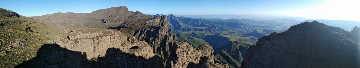
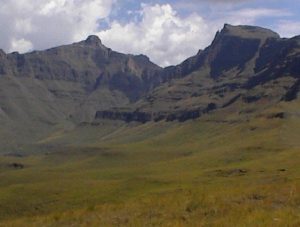
The trail is named after the Giant’s Cup, which is a prominent feature on the escarpment in the Underberg district. The “cup” is the bowl between Hodgson’s Peaks. On a clear day, as you enter Underberg from the east, the Giant’s Cup can be seen standing proudly in the distance beyond the village and farmlands, framed by an avenue of trees in the foreground. Behind the cup lies the Mountain Kingdom of Lesotho, and to its right, Sani Pass. Masubasuba Pass summits at the lowest point of the cup.
The Giant’s Cup Trail was one of the original trails of the National Hiking Way System established by the now defunct Department of Forestry under the leadership of Dr Fanie Botha. The intention was to establish a series of self-guided trails that would eventually allow one to hike from Messina (now Musina) in the far north, to Cape Point in the far south of South Africa. Quite a number of such trails were created, but sadly some were discontinued after the project was abandoned, while others like the Giant’s Cup, Otter, Tsitsikamma and Fanie Botha continue to thrive. Also sadly, the original high-quality waxed trail maps by Peter Slingsby, and the sew-on cloth badges for each trail, are no longer available. The future of the Giant’s Cup Trail seems assured for now, due to its popularity and support from the local community.
A characteristic of all the National Hiking Way System trails is that their accommodation was set at 30 hikers per hut. This still holds true today, so the Giant’s Cup Trail huts each accommodate 30 hikers. Though this figure is seldom reached these days, it was not uncommon for them to be filled to capacity in the early days of the trail system.